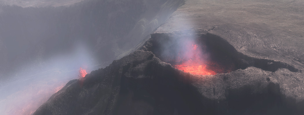
2'000 years ago, an huge eruption at Commerson sent lava down the Rivière des Remparts to the sea. The deep crater is interpreted as a collapse structure. Our 2016 simulation explores the eruption in five stages, between geological evidence and choices made to try the reconstruction !
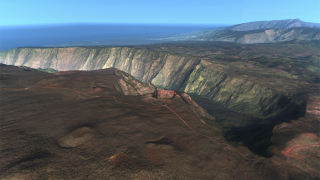
Commerson lies on the Plaine des Remparts, outside the Enclos Fouqué, at the eastern edge of the Rivière des Remparts valley. Its reported dimensions are approximately 230 m by 150 m, with a maximum depth of 235 m. [1]
The eruption occurred roughly two thousand years ago. Radiocarbon dating provides an age range, rather than an exact year; the often-quoted date of 60 CE should be read with that limitation in mind. [2]
A deep pit does not, by itself, establish that an explosion excavated it. The site-specific interpretation by Laurent Michon identifies Commerson as a collapse crater. Its walls expose older lava flows beneath deposits from the eruption. [1]
The preserved crater and the associated valley lavas provide useful constraints for a reconstruction. They do not record every detail of the eruption.
The five stages follow the existing 2016 illustrations. They combine field evidence with an illustrative scenario; their duration, precise appearance and timing are not a documented chronology. Lava advance, fountaining and collapse may have overlapped.
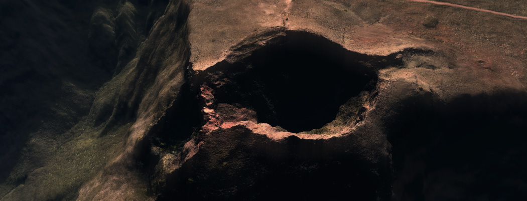
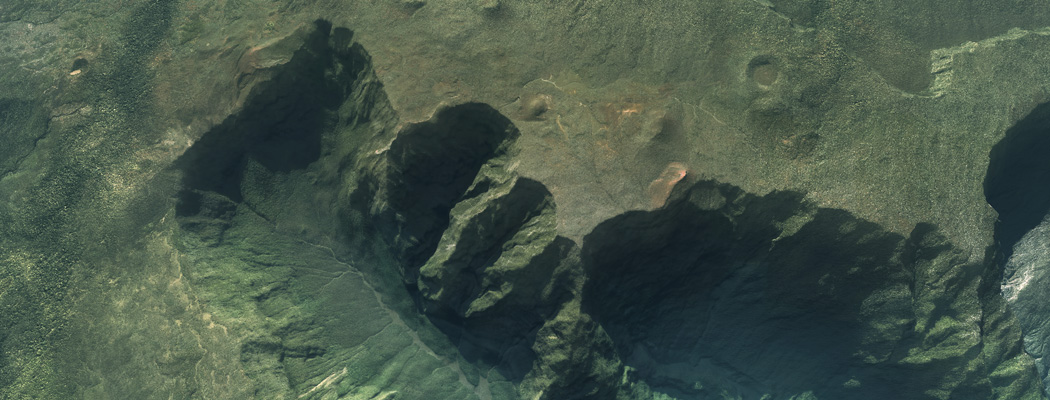
The reconstruction begins by removing the modelled lava fill from the modern elevation model to suggest the landscape before the eruption. This is an inferred starting surface !
The opening sequence moves from the present-day crater to a credible pre-eruption landscape. The valley depth shown is a modelling choice: subtracting lava from modern topography !
The reconstruction then introduces eruptive fissures and lava fountains. Fountaining before collapse is supported by welded deposits and volcanic bombs at the site. The opening time of each vent and the height of the fountains remain unconstrained here. [1]
Fountains eject molten fragments as well as feeding lava flows. Note : we can't call this activity simply “non-explosive” as it would obscure the role of magmatic gas expansion.
Video 1 — 0:43 — 720p mp4
The simulation shows ejected fragments accumulating around the upper vent. This illustrates the construction of a cone before the ground beneath the vent collapses.
Video 2 — 0:37 — 720p mp4
The final cone in this sequence grows through the accumulation of simulated particles. Its geometry depends on the selected vent parameters and the rules used for fragment deposition.
The surviving eruption deposits support a constructional phase, but they do not uniquely determine a large, isolated cone with the exact silhouette shown. Its original height, footprint and growth time are choices in this reconstruction, from today crater's borders.
An edifice above a collapsing vent could have subsided into the developing pit. Its disappearance would therefore not require a blast to eject the whole cone. This is a possible consequence of collapse, rather than a direct measurement of how the cone disappeared.
The third sequence shows drainage towards lower outlets and the formation of a deep pit. Collapse is the geological interpretation to emphasise when viewing this stage.
Eruptive fissures are mapped on the plateau, in the rempart and on the valley floor; the associated Trou Fanfaron pit lies northwest of Commerson. The interpretation is that lower outlets drained shallow magma-transfer zones, allowing their roofs to collapse. [1]
The morphology suggests two nested collapse structures. The exact sequence of subsidence and vent opening is unresolved; the animation’s distinct stages simplify this evolution.
What about the explosion? Older literature, including Tanguy et al. (2011), describes phreatomagmatic activity at Commerson. That interpretation should be acknowledged, but it does not establish that a single steam-driven blast excavated the present crater. [2]
Video 3 — 0:53 — 720p mp4 — original illustrative drainage sequence
The fourth sequence depicts lava ponding inside the newly formed pit. A lava lake is a possibility explored by the reconstruction.
Video 4 — 0:30 — 720p mp4
If magma continued to reach an open vent within the pit, lava could have accumulated there temporarily. Whether this occurred at Commerson, and at what level or for how long, is not established by the site descriptions cited here.
The lake shown should therefore be read as a scenario. Its simultaneous connection to a lower outlet is also an assumption of the reconstruction, not a mapped underground conduit.
In the animation, fountains remain below the rim because the modelled pit now is deeper than their selected height.
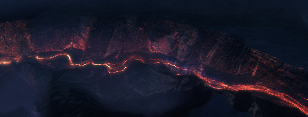
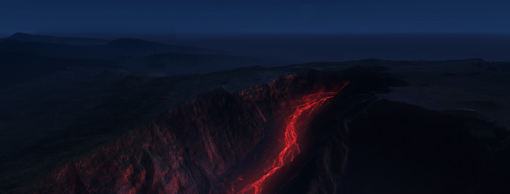
The final sequence follows the lava down the Rivière des Remparts. This part is certain, its journey to the coast is a geological constraint !
Lavas attributed to the Commerson eruption followed the valley for more than 20 km to the coast near Saint-Joseph. The published hazard assessment includes geological mapping of their coastal extent. [3]
The original reconstruction used a total lava volume of 200–300 million m³. Here that range is retained as a scenario parameter.
The scanario explores how this volume spreads over the terrain, final eruption history, lava flow thickness and arrival time at the coast !
Time has passed, the modern valley also reflects subsequent erosion, sedimentation and slope failures. Its present surface is no more exactly the intact top of the Commerson lava flows !
Video 5 — 0:56 — 720p mp4
Note for scientific reading : the observations, geological interpretations and simulation choices have different levels of certainty. These distinctions are essential to understanding the five stages.
The site interpretation favours collapse. Older accounts mention phreatomagmatism, but the evidence cited here does not specify the number, timing or importance of any accompanying explosions. Neither crater depth nor a dramatic animation resolves that question.
Several starting surfaces could be compatible with the available terrain. Differences affect flow paths, travel times, thickness and inferred volume; reproducing the coastline reached by the lava is only one constraint.
The exact cone shape, its height and the lake stage are not uniquely documented. They illustrate possible conditions. The video lengths are presentation timings, not eruption durations.
Ort et al. (2016) identify at least three Bellecombe explosive eruptions between about 5 465 and 2 971 calibrated years BP. These older events provide regional context, not evidence for a Commerson explosion or for the number of its eruptive phases. [4]
The 200–300 million m³ range belongs to the original reconstruction. Establishing the erupted volume requires separating the eruption’s lava from older rocks, later deposits and material lost to erosion. A visually convincing result does not settle that estimate.
Tanguy et al. (2011, Table 2) report 1 890 ± 75 radiocarbon years BP for Commerson, based on Bachèlery’s earlier dating. Their calibration gives 20–380 CE at 95.4% probability. BP is referenced to 1950; a radiocarbon age must be calibrated before being expressed as a calendar date. This supports “roughly two thousand years ago”, not an eruption known to have happened in exactly 60 CE. [2]
The engine can explore the consequences of prescribed terrain, vent activity and lava properties within its implemented physics. It cannot identify a unique historical sequence from the resulting images. Depicting crater formation also does not demonstrate that the model independently computes underground magma drainage, rock failure or water–magma fragmentation.
Site-specific geology and published dating take priority over the visual scenario. The Bellecombe study is included for regional context only.
If you work on Piton de la Fournaise and would like a scenario tested against your own field constraints, we would like to hear from you.
The five phases assembled into a single sequence, from the present-day valley to the lava reaching the ocean.
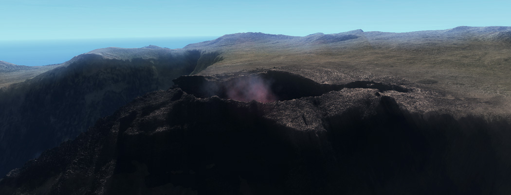
Give us a digital elevation model and a geological scenario, and the engine can explore lava movement on that landscape — within the processes and assumptions represented by the model.